American Red Cross
See the following -
2015 Was a Good Year for Creating the World's 'Missing Maps' with OpenStreetMap
 The Missing Maps project, which launched in 2014, aims to literally and figuratively put more than 20-million at-risk people on the map using OpenStreetMap (OSM) as a platform. We need to fill in "missing maps" before the next disaster strikes, ensuring the maps have detail sufficient for emergency responders to hit the ground running. OpenStreetMap is an open and free source of geographic data. Anyone with a username can add, edit, or update data, so the Missing Maps project is community driven and focuses on local knowledge. Remote volunteers around the world use satellite imagery to trace features, such as roads and buildings. Community members and volunteers in the area then use the base map to add local data to these shapes, including street names, addresses, building types, and points of interest. As we look back at 2015, here are a few success stories from the Missing Maps project...
- Login to post comments
6 Smartphone Apps To Help Fight Hurricane Sandy's Fury
If you live in the Northeastern United States and are bracing for Hurricane Sandy's wallop, your smartphone can become a handy tool if disaster strikes. Read More »
- Login to post comments
Developers from 156 Nations Work on Open Source Apps to Help Victims of Natural Disasters. Project OWL Wins 'Call for Code Global Prize'
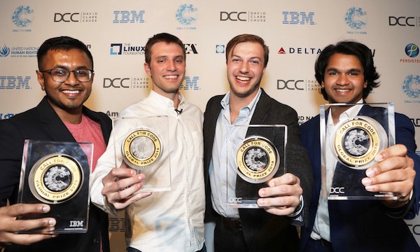 With the global reach and vision of Call for Code Creator David Clark Cause, Founding Partner IBM, and Charitable Partners United Nation Human Rights and The American Red Cross, the largest engagement of developers in history culminated with the Call for Code Global Prize winners and finalists being celebrated last night during a gala event globally broadcast from The Regency Ballroom in San Francisco. Knowing that people suffer when communications are destroyed when natural disasters strike, Project OWL is an innovative software/hardware solution that includes an offline communication infrastructure, providing first responders with a simple experience for managing all aspects of disaster response.
- Login to post comments
Engaging Citizens the Right Way: Government Uses Twitter During Hurricane Irene
For the last several years there has been a lot of discussion about the use of web based social media for the engagement of citizens. Nowhere has this discussion been more active and persistent, nor more important, than in what I will call broadly the emergency preparedness and response (EPR) community. Read More »
- Login to post comments
How Online Mapmakers are Helping the Red Cross Save Lives in the Philippines
It will be months before we know the true damage brought about by super typhoon Haiyan. The largest death tolls now associated with the storm are only estimates. Aid workers from across the world are now flying to the island nation, or they just recently arrived there. Read More »
- Login to post comments
How Open Government Is Helping With Hurricane Relief in Puerto Rico
 Just weeks after Hurricane Harvey hit Texas, two more "unprecedented" hurricanes made their way to the southeastern United States. Although changes in Hurricane Irma's path spared Florida from the bulk of the damage, both Irma and Maria directly hit Puerto Rico and the U.S. Virgin Islands. Hurricane Maria was particularly devastating for the more than 3.5 million American citizens living in these U.S. Caribbean territories. The CEO of Puerto Rico's sole electric company indicated that the grid had been "basically destroyed." Without electricity, communications were severely limited. In the aftermath of a natural disaster, embracing open government principles—such as open data, collaboration between citizens and government, and transparency—can save lives.
- Login to post comments
IBM Announces Additional $25 Million Investment to Develop Open Source Tech for Disaster Response
![]() IBM today announced Code and Response, a new $25 million, four-year deployment initiative to put open source technologies developed as part of coding challenges such as Call for Code in the communities where they are needed most. Code and Response includes resources to build, fortify, test, and implement solutions at scale. The initiative is supported by hundreds of IBMers as part of the IBM Corporate Service Corps, as well as government and NGO partners to put those technologies to work saving lives.
IBM today announced Code and Response, a new $25 million, four-year deployment initiative to put open source technologies developed as part of coding challenges such as Call for Code in the communities where they are needed most. Code and Response includes resources to build, fortify, test, and implement solutions at scale. The initiative is supported by hundreds of IBMers as part of the IBM Corporate Service Corps, as well as government and NGO partners to put those technologies to work saving lives.
- Login to post comments
IBM Commits $30 Million Towards Open Source Disaster Response Tech
![]() IBM and partners today launched the Call for Code Global Initiative, the largest and most ambitious effort to bring startup, academic and enterprise developers together to solve one of the most pressing societal issues of our time: preventing, responding to and recovering from natural disasters. During a keynote address at the VivaTech Conference in Paris, IBM Chairman, President and CEO Ginni Rometty called on the technology industry to help build a better future, committing IBM technology and $30 million USD over five years in the annual Call for Code Global Initiative. Its goal is to unite the world's developers and tap into data and AI, blockchain, cloud and IoT technologies to address social challenges.
IBM and partners today launched the Call for Code Global Initiative, the largest and most ambitious effort to bring startup, academic and enterprise developers together to solve one of the most pressing societal issues of our time: preventing, responding to and recovering from natural disasters. During a keynote address at the VivaTech Conference in Paris, IBM Chairman, President and CEO Ginni Rometty called on the technology industry to help build a better future, committing IBM technology and $30 million USD over five years in the annual Call for Code Global Initiative. Its goal is to unite the world's developers and tap into data and AI, blockchain, cloud and IoT technologies to address social challenges.
- Login to post comments
Online Army Helps Map Guinea's Ebola Outbreak
Health workers responding to an Ebola outbreak in Guinea had no maps to go on, so they turned to the internet for help
- Login to post comments
Open Source at the American Red Cross
When local and national disasters happen, organizations like the American Red Cross are there to provide emergency relief. Quickly and effectively mobilizing over a million volunteers is a technological challenge that regional American Red Cross divisions are turning to open source to solve. Read More »
- Login to post comments
Open-Source Mapping The World's Most Vulnerable Regions Will Save Lives
Urgent humanitarian aid missions are slowed when cities are largely unmapped. Missing Maps aims to change that with the help of volunteer cartographers and local residents. Read More »
- Login to post comments